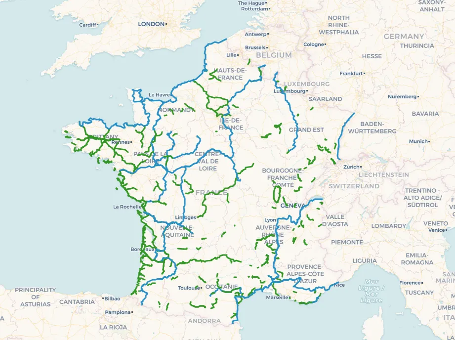
Saosnois Green Route (Mamers - Les Mées - Cherancé)
18.00 km
Grindasfalt
Description
The greenway, built on a former railway line, currently stretches for about twenty kilometers. It offers a pleasant ride through the Sarthe countryside, bordering the Orne department. It crosses a Roman road and allows for short detours to nearby villages: Mamers, Saint-Longis, Vezot, Saint-Rémy-du-Val, Les Mées, Thoiré, Grandchamp, and Chérancé. Loops and circuits are also available, using this greenway, which serves as the main route for exploring the area. We are here on the edge of the Normandy-Maine Regional Natural Park and close to the Perche Regional Natural Park. The greenway is a must-do during a stay in rural accommodations (gîtes, bed and breakfasts, hotels, campsites, etc.) around Mamers, the Saosnois region, and the Perche.

Map of the Saosnois Green Route (Mamers - Les Mées - Cherancé)