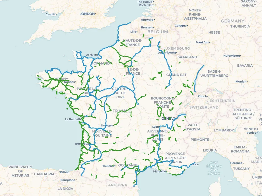
Vilaine Green Way: Rennes - Guipry-Messac (V42)
47.00 km
Description
The Vilaine greenway begins in the heart of Rennes and this section ends in Guipry-Messac. It is part of a larger network (the V42 or V2 Brittany) that connects Saint-Malo to the Gulf of Morbihan at Arzon and the Rhuys peninsula (itself well-served by cycle paths for tourists). The route follows the Vilaine River, starting on the outskirts of Rennes, then quickly heading south. For most of its length, it follows the towpath along the river and passes through the villages of Vezin-le-Coquet, Chavagne, Saint-Jacques-de-la-Lande, Bruz, Goven, Laillé, Saint-Senoux, Bourg-des-Comptes, Guichen, Pléchâtel, and Saint-Malo-de-Phily, before reaching Guipry-Messac where it continues towards Redon. A very beautiful stage, to travel through Brittany from North to South, from the North Sea to the Atlantic Ocean, starting from the Breton capital: Rennes.